Winter Severity Index
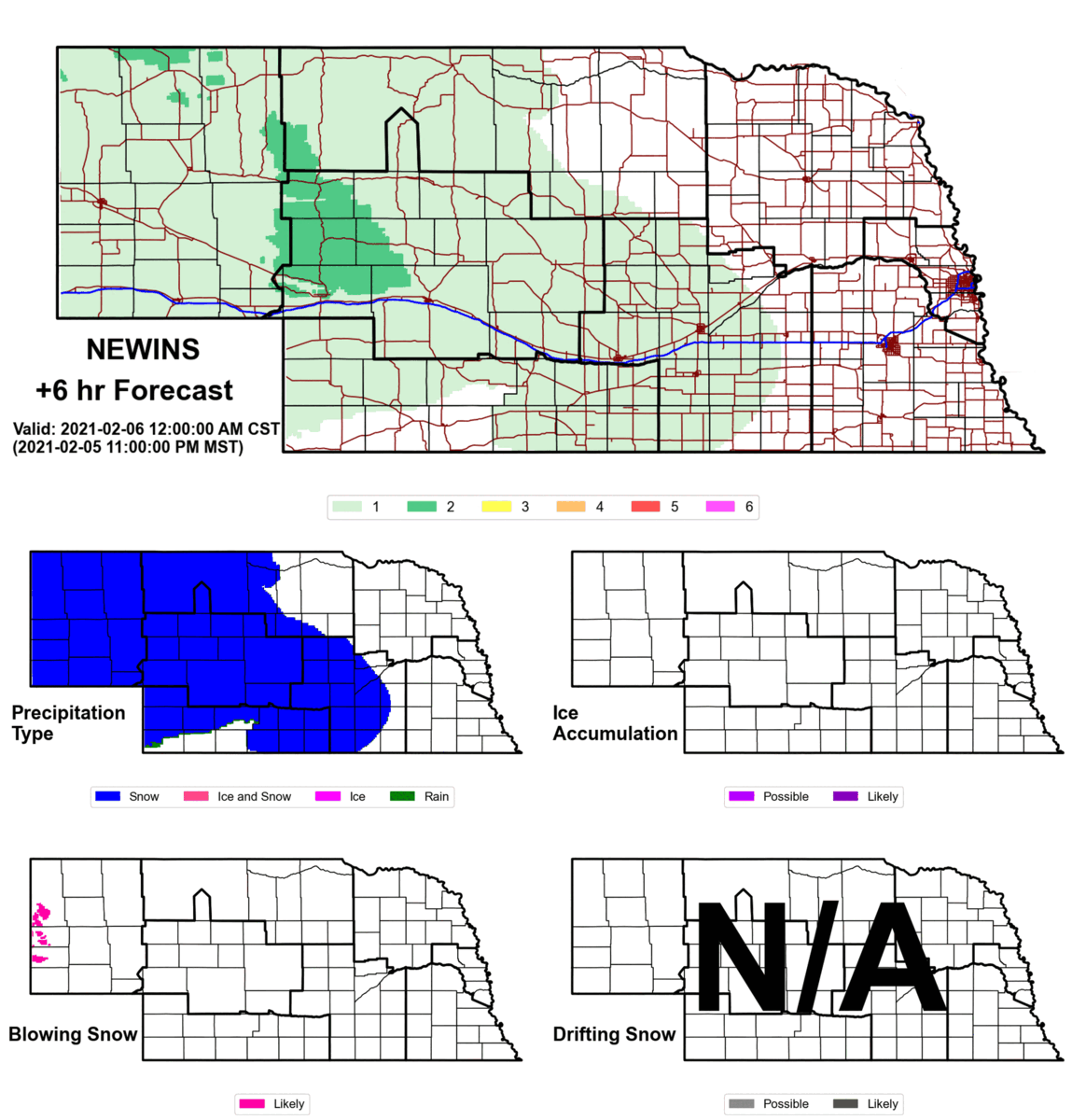
Winter Severity Index: NEWINS 2021
Winter Severity Index Tool
Winter Severity Indices (WSIs) enable state Departments of Transportation (DOTs) to gauge hazardous winter weather across spatial and temporal scales. Historically, WSIs have been used for post-event assessment of resources and expenditures for individual storms and across entire winter seasons. However, predictive WSIs allow for pre-storm resource/personnel planning, coordination across agencies, and public-facing hazard/risk communication.
RAL collaboration with the University of Nebraska-Lincoln (UNL) for the Nebraska Department of Transportation (NDOT) has led to the development of the Nebraska Winter Severity Index (NEWINS). NEWINS provided a new, independent framework for assessing a winter season’s severity by categorizing individual winter storms. This framework has been extended to other states as well (e.g., Colorado Winter Severity Index [COWINS]).
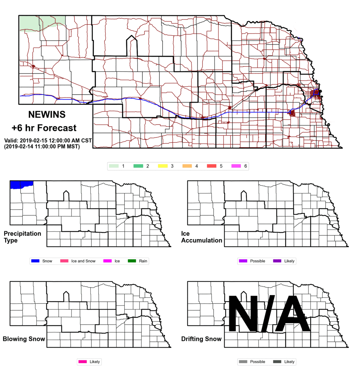
Winter Severity Index: NEWINS 2019
Recent work led by Thomas Kauzlarich and Mark Anderson (UNL) and RAL’s Curtis Walker has translated the NEWINS categorial framework into predictive modeling and expanded NEWINS to include other in-storm weather hazards, such as freezing rain and blowing snow, and post-storm hazards like drifting snow. The NEWINS algorithms have been interpolated using the National Digital Forecast Database (NDFD), which is used by the National Weather Service (NWS) to produce gridded forecasts. The new and expanded NEWINS provides spatial maps up to 72 hours in advance for precipitation type, ice accumulation, blowing snow, and drifting snow. Time series for NEWINS, and its new components, can be extracted throughout the contiguous US.
The translation from historic to predictive NEWINS has offered a new way of looking at WSIs. Specifically, such WSIs can now capture weather hazards beyond only the period of precipitation and assess forecast model changes over time. The spatial and temporal capabilities of the newly expanded WSI framework benefits state DOT winter maintenance operations and decision support. Moreover, this framework is complementary to ongoing NWS efforts to modify its Winter Storm Severity Index and ongoing conversations regarding initiatives such as Pathfinder.