Climate Downscaling Methodology
The ongoing need for high-resolution regional climate models
Climate Downscaling Methodology
The ongoing need for high-resolution regional climate models
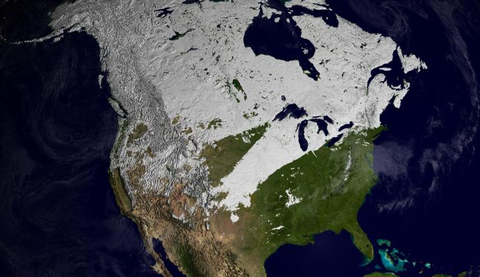
It is well understood that the characteristics of snowfall and the subsequent accumulation of winter snowpacks across the continental United States (US) will change in a warmer climate. These changes will have important implications for many sectors including water supply, drought and wildfires, recreation, flooding, and the occurrence of hazardous snowstorms. Snow is a normal part of the climate for most regions of the US, so these changes will potentially affect a significant fraction of the US population. It is therefore critical that US decision makers are armed with integrated projections of long-term climate changes affecting snowfall for the entire US when preparing for future climate conditions. Future changes in snowfall and SWE are complex because they depend on the integrated response of temperature, moisture, precipitation, and extratropical cyclones (ETCs, the storms that are associated with most winter precipitation over the US). Existing studies have not systematically approached the integrated complexity of these changes over the US, leading to gaps in our understanding of the risks and uncertainties relating to future snowfall. Previous snow-specific studies have primarily focused on grid-point examinations of changes in mean snowfall. What remains largely unknown is how the frequency, intensity, and spatial distribution of snowfall will change within individual ETCs across the US in a warming climate. It is critical that changes in snowfall are studied at this scale because the influence of snowfall is often felt at the individual snowstorm level. On the East Coast, heavy snowfall events can cause considerable harm to urban populations, impeding transportation and damaging infrastructure. On the West Coast, the occurrence of individual extreme snowfall events largely drives the year-to-year variability in annual water supply.
In this study we track individual ETCs in reanalysis and CMIP6 climate models using TempestExtremes (Ullrich and Zarzycki, 2017; Ullrich et al, 2020), an automated, point-wise tracking algorithm. ETCs are tracked using the 24-hour variance in mean sea level pressure. We then analyze storm-scale precipitation and snowfall in the historical and future CMIP6 climate model simulations. Where storm-scaled precipitation is captured using a radius of 15º great circle distance from the storm center. We are examining regional variations in how cold-season precipitation and snowfall change in ETCs within CMIP6.
Representative Projects
- A Framework for Improving Analysis and Modeling of Earth System and Intersectoral Dynamics at Regional Scales - HyperFACETS
- Bias-Correction
- Machine Learning
- LUC in RCMs
- Future Changes in Storm Relative Precipitation and Snowfall over CONUS
Publications
-
The ongoing need for high-resolution regional climate models: Process understanding and stakeholder information
Description
Gutowski Jr., W. J., and Coauthors, 2020: The ongoing need for high-resolution regional climate models: Process understanding and stakeholder information. Bull. Amer. Meteor. Soc., 101, E664–E683, https://doi.org/10.1175/BAMS-D-19-0113.1.
-
A new distribution mapping technique for climate model bias correction
Description
McGinnis S., D. Nychka, and L. O. Mearns, 2015: A new distribution mapping technique for climate model bias correction. Machine Learning and Data Mining Approaches to Climate Science, 91-99, https://doi.org/10.1007/978-3-319-17220-0_9.
-
SSP-based land use change scenarios: a critical uncertainty in future regional climate change projections
Description
Bukovsky, M.S., J. Gao, L. O. Mearns, and B. O’Neill, 2021: SSP-based land use change scenarios: a critical uncertainty in future regional climate change projections. Earth’s Futures, 9, e2020EF001782. https://doi. org/10.1029/2020EF001782
Presentations
-
Future changes to extratropical cyclones and their storm-relative precipitation and snowfall over North America
Description
McCrary, R. R., M. S. Bukovsky, C. M. Zarzycki, , and L. Kessenic, 2022: Future changes to extratropical cyclones and their storm-relative precipitation and snowfall over North America. In 102nd American Meteorological Society Annual Meeting. AMS. http://n2t.net/ark:/85065/d74b34sx.
-
Evaluation of extratropical cyclones and their associated precipitation and snowfall over North America in CMIP6
Description
McCrary, R. R., M. S. Bukovsky, and C. M. Zarzycki, 2021, December: Evaluation of extratropical cyclones and their associated precipitation and snowfall over North America in CMIP6. In AGU Fall Meeting 2021. AGU. https://ui.adsabs.harvard.edu/abs/2021AGUFM.A45F1915M/abstract.