Graphical Turbulence Guidance Nowcast (GTGN™)
Since it is a forecast product, the GTG is most useful for route planning, i.e., strategic avoidance of turbulence. However, given the rapidly evolving character of turbulence, for tactical avoidance it is more useful to have a rapidly updated nowcast system. This system, called GTGN™ (N for nowcast), has been developed at RAL and is primarily driven by the most recent available turbulence observations (in situ EDR measurements, turbulence pilot reports, NTDA output, and satellite–based turbulence inferences) merged together with a GTG short–term forecast. The product updates every 15 min.
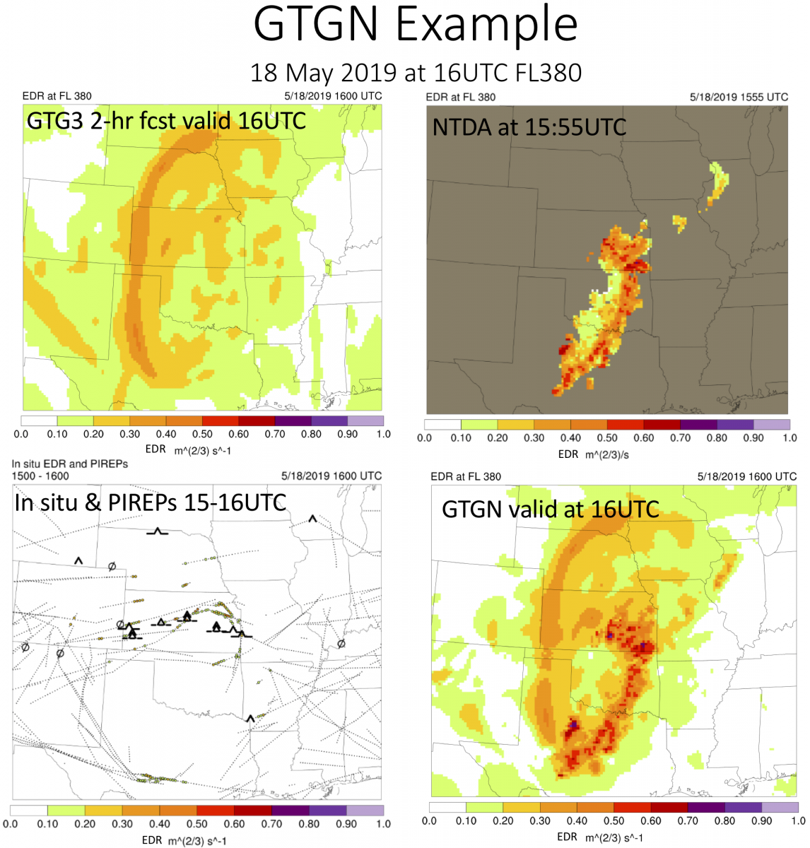
The GTGN™ procedure uses GTG short–term forecast grids which are modified on a point–by–point basis to provide better agreement with the latest observations. The observations used include PIREPs, in situ EDR data, lightning, Metar and NTDA EDR measurements. The gridded output is EDR. An example of the adaptive procedure is shown in the bottom right figure.
The operational GTGN™ system is now available from the National Weather Service.".
Contact
Please direct questions/comments about this page to: