Fuel Moisture Content Retrievals
Dead and live fuel moisture content retrievals over the U.S.
Overview
Dead and live fuel moisture content (FMC) are essential for, among other aspects, effectively estimating fire danger and for initializing models used tactically to manage wildland fires and understand their behavior. Unfortunately, FMC observations are sparse for dead FMC and even sparser, and infrequent, for live FMC. To overcome these limitations we have developed regression models that use machine learning (ML) to estimate the dead and live FMC. The ML models use as predictors near surface variables from numerical weather prediction models such as the High Resolution Rapid Refresh model, and data from: 1) the Visible-Infrared Imaging Radiometer Suite (VIIRS) instrument on board of circumpolar satellites; and 2) the Advanced Baseline Imager (ABI) aboard GOES geostationary satellites.
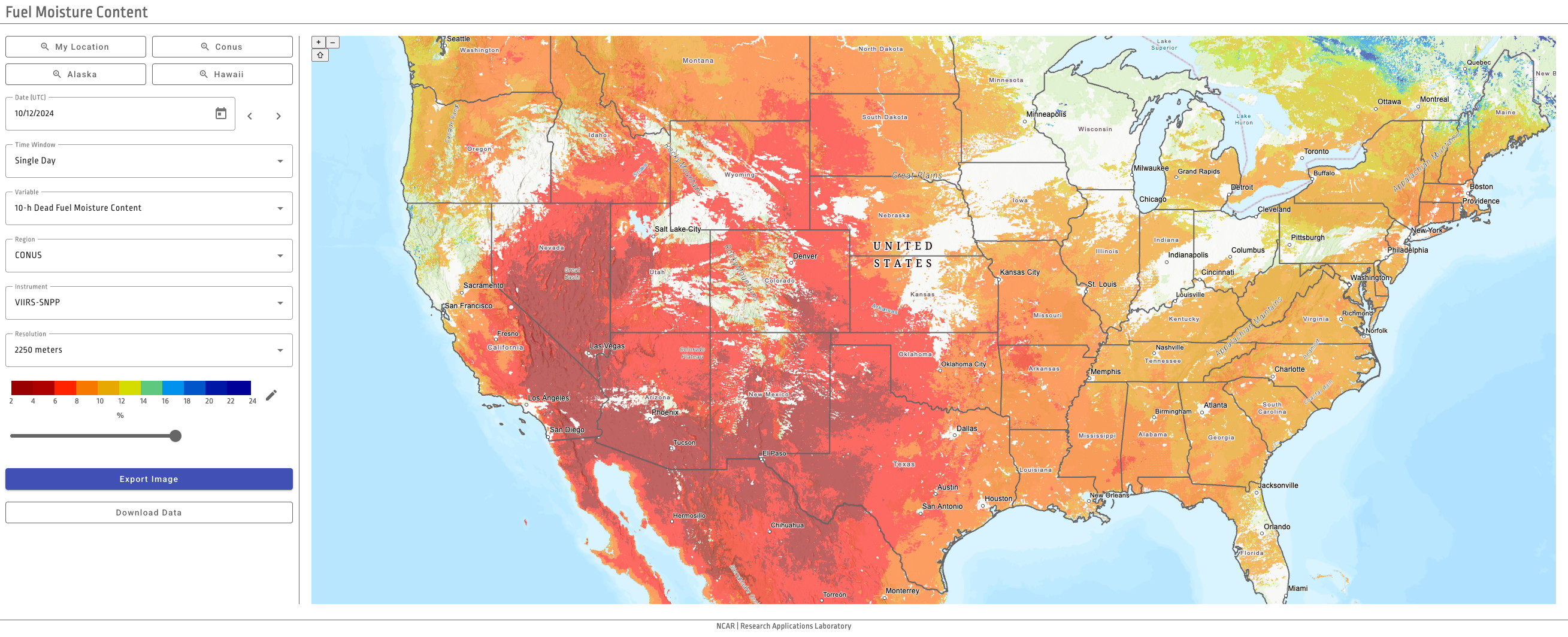
To illustrate the value of the FMC retrievals we started a real time demonstration of the products in February 2023. The FMC retrievals are publicly available and can be downloaded from the “DOWNLOAD DATA” button further down on this website. There is also a visualization application to display the retrievals also available from a button below.
Demonstration Description
In March 2023 we started a real-time demonstration of the fuel moisture content retrievals based on VIIRS. The retrievals are available at a range of spatio-temporal resolutions. Over the contiguous U.S. (CONUS) and Alaska the retrievals are available at 2250 m and 3000 m, respectively, as well as at 375 m. Over Hawaii, the retrievals are available at 750 m.
Over CONUS, in addition to the daily retrievals based on the VIIRS daytime overpasses there are also hourly retrievals based on the geostationary satellite GOES in the East position. The hourly fuel moisture content retrievals based on GOES-East are available at 2250 m grid spacing.
Besides having just VIIRS based retrievals or ABI based retrievals, we are also combining products from ABI and VIIRS to obtain finer spatio-temporal resolution than any of the instruments alone. VIIRS data provides high spatial resolution, ABI data high temporal resolution. The two datasets are being blended to estimate, for example, FMC at a 375-m granularity over CONUS with 3-h frequency.
Besides having a single generic live FMC retrieval, the VIIRS-based retrievals also include the live FMC for trees, shrub, and grasses.
A summary of the retrievals over CONUS across the Predictive Service Areas is also available.
There is an application to visualize the real-time, and archived, retrievals which can be explored to better appreciate the products and instruments that are available: https://fmc.ral.ucar.edu
Resources
- Dataset of FMC retrievals over CONUS, Alaska, and Hawaii
-
Machine learning and VIIRS retrievals for skilfull fuel moisture content monitoring in wildfire management
Description
Schreck, J.S., W. Petzke, P.A. Jimenez, T. Brummet, J.C. Knievel, E. James, B. Kosovic, D.J. Gagne, 2023: Machine learning and VIIRS retrievals for skilfull fuel moisture content monitoring in wildfire management. Remote Sensing, 15, 3372.
-
Quantifying VIIRS and ABI contributions to hourly dead fuel moisture content estimation using machine learning.
Description
Schreck, J.S., W. Petzke, P.A. Jimenez y Munoz, and T. Brummet, 2026: Quantifying VIIRS and ABI contributions to hourly dead fuel moisture content estimation using machine learning. Remote Sensing, 18, 318.
- The Community Fire Behavior Model
Contact
Please direct questions/comments about this page to:
Pedro Jimenez Munoz
Senior Scientist