Avoiding Dangerous Weather on Long Oceanic Flights
Airline adopting satellite-based technology developed by NCAR

Flight crews for the first time can now anticipate hazardous storms while navigating long-range, oceanic routes. Knowing a 40,000-foot convective storm is ahead allows flight crews to reroute its flight path, saving on fuel costs, manpower and agita to the passengers on board.
Lufthansa Airlines, NCAR, and Basic Commerce & Industries, Inc. (BCI) have recently completed a feasibility study using the satellite-based Cloud Top Height (CTH) product to assist pilots in identifying and strategically avoiding storms that are beyond the range of the airplane's onboard radar. Finding the product overwhelmingly useful in the cockpit, Lufthansa isn't hesitating to adopt it. Leading the competition, Lufthansa is implementing its entire fleet with this transoceanic system, revolutionizing how flight crews can avoid dangerous convective storms. Global coverage of the CTH product is now being provided through addition of a fourth partner, Weather Solutions Division of the Sutron Corporation.
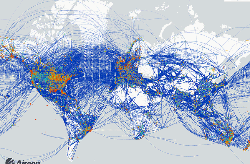
There's a good reason why the airline is proactively adopting this new technology; oceanic flights have limited access to detailed weather information that is available to over-land flights due to the lack of ground-based radar networks. Ground-based radar coverage available when flying over continents provides a clear, real-time snapshot of storms that the aviation community uses extensively. Not so over the oceans. Here, geostationary satellites provide real-time coverage of storm location and intensity.
Leveraging Years of Basic Research and Applied Science

NCAR has decades of experience and successes helping domestic and international airlines improve flight safety and efficiency. Since the early 1980s, NCAR was a leader in the study of microbursts, those violent and deadly storms that took down a number of flights before scientists understood the phenomena and developed radar-based technologies to detect them. NCAR's unique structure of partnering atmospheric scientists conducting basic research with engineers who design custom systems to address the problem, has resulted in life-saving applications to other aviation hazards, such as icing and turbulence.
NCAR's programs focusing on "weather in the cockpit" technologies dates back to the early 1990s. From 1999-2011, it partnered with the National Aeronautics and Space Administration (NASA) and the Federal Aviation Administration (FAA) Aviation Weather Research Program (AWRP) to study satellite-based techniques to detect oceanic convection and then predict their future location. From 2011-2012, NCAR partnered with the FAA Weather Technology in the Cockpit (WTIC) program to assess the usefulness of displaying a convective product on an electronic flight bag and how pilot decision-making was affected. Forward to today, and now transoceanic pilots have new weather display technologies that have been long-awaited.
Distilling and translating a mountain of data to help pilots make route decisions
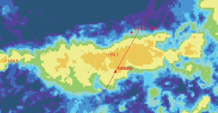
Over the oceans, geostationary satellites provide critical information by measuring the brightness temperatures of the tops of clouds. Matching the brightness temperature to an atmospheric temperature and then to the pressure level from a numerical model sounding (i.e., the Global Forecast System, or GFS) provides an estimate of the height of the cloud top. The resulting gridded output is called the Cloud Top Height (CTH) product. Next, particular CTH contours are selected for their relevance to aircraft flying transoceanic routes (i.e., between 30,000-50,000 feet) and used to create polygons. Simplifying the storm's area into a small number of latititude/longitude pairs that define the polygon allows their transmission to the aircraft over limited bandwidth. An Open Geospatial Consortium interface, called the Web Feature Service (WFS), serves the polygons to the airline. The WFS is compatible with FAA Next Generation Air Transportation System (NextGen) architecture. The airline then displays the CTH polygons on a tablet or electronic flight bag in the cockpit. The polygons are displayed over the navigational charts giving the pilot situational awareness of storm hazards over the planned flight route.


With expansion to global coverage, the project is now introducing the Convective Diagnosis Oceanic (CDO) product as an overlay to CTH. This product better defines the convective hazardous regions by utilizing additional satellite-based algorithms to better define storm structure in conjunction with global lightning data. These results are combined using a data fusion that computes the gridded CDO product. While the CTH product defines the entire storm structure, including the anvil, the CDO product illuminates the location of the updrafts where the convective hazards reside.
Back at Home: Products will support NextGen
On the home front, NCAR has been a leader in supporting the FAA NextGen, the national priority of meeting the growing air transportation needs of the future. Demand for air traffic services is expected to rocket, possibly on the order of three times today's demand levels. Because weather conditions can seriously restrict aircraft operations, how this information is observed, forecast, disseminated, and used in decision-making is of critical importance. The Cloud Top Height and Convective Diagnosis Oceanic products have been designed to fulfill this need for the transoceanic aviation community.
Laura Curtis is a writer for NCAR's Research Applications Laboratory