Storm surges can cause serious flooding FAST
Visualization developed by the NCAR GIS program at RAL
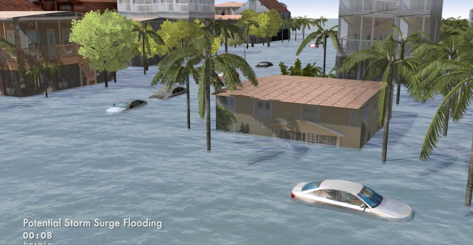
Major storm surge is forecasted for coastal areas in the U.S. due to Hurricane Irma. The NCAR GIS program in the Research Applications Laboratory developed this 3-dimensional GIS-based animation of storm surge inundation through the NSF-funded CHIME project in collaboration with the NCAR Mesoscale and Meteorology Laboratory and University of Georgia Marine Extension and Georgia Sea Grant. This simulation demonstrates how quickly storm surge flooding can occur.
This research is supported by National Science Foundation Award 1331490. The National Center for Atmospheric Research is sponsored by the National Science Foundation.
NCAR GIS Geographical Information Systems Program
National Science Foundation (NSF)