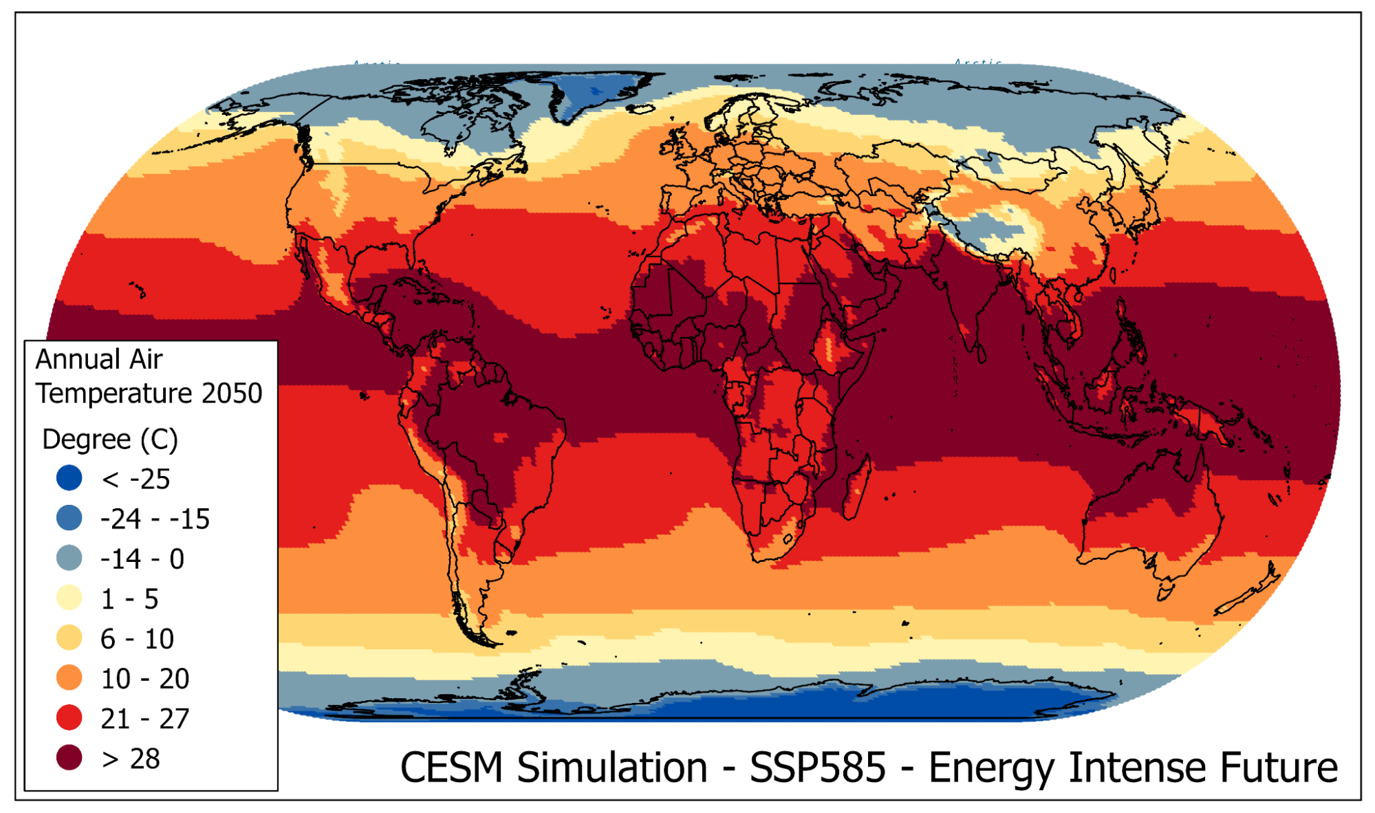
News

An extraordinary new dataset of high-resolution weather simulations that span more than four decades over the continental United States is now available to the Earth system science community.

Simultaneous outbreaks of large wildfires will become more frequent in the West, putting major strains on efforts to fight the blazes.

Best Practices for Mapping Storm Surge Inundation

The Sublimation of Snow field project will eventually help water resource managers to better quantify critical water resources stored in mountain snowpacks.

An advanced computer modeling technique reveals that non-white and lower-income residents of U.S. cities face greater heat stress.

Researchers examine the potential for urban areas to experience heavier rainfall and flooding risks in the future.

Learn more about the power of GIS to advance climate research and communication in our ArcGIS StoryMap, "The Power of GIS".

NCAR has successfully developed an advanced solar energy forecasting system for New York that offers the potential to help the state achieve its renewable energy goals while saving millions of dollars for ratepayers.

A new computer modeling technique developed by NCAR scientists offers the potential to generate months-ahead summertime drought forecasts across the Western United States with the capability of differentiating between dry conditions at locations just a couple of miles apart.